{{ tocSubheader }}
{{ 'ml-label-loading-course' | message }}
An error ocurred, try again later!
Chapter {{ article.chapter.number }}
{{ article.number }}.
{{ article.displayTitle }}
{{ article.intro.summary }}
Show less Show more expand_more Lesson Settings & Tools
| | {{ 'ml-lesson-number-slides' | message : article.intro.bblockCount }} |
| | {{ 'ml-lesson-number-exercises' | message : article.intro.exerciseCount }} |
| | {{ 'ml-lesson-time-estimation' | message }} |
It is sometimes utterly impossible to accurately model an object or real-life scenario using the original dimensions. Here, scale drawings and models come into action. This lesson will expand on how these tools are instrumental in modeling some common cases.
Catch-Up and Review
Here are a few recommended readings before getting started with this lesson.
Challenge
Maps and Actual Distances
On a sunny Saturday morning, Kevin — a boy with a passion for formula 1 racing cars — wakes up and finds a letter sitting on the table. It is from his pops.


{"type":"text","form":{"type":"math","options":{"comparison":"1","nofractofloat":false,"keypad":{"simple":true,"useShortLog":false,"variables":[],"constants":[]},"rendered":false},"text":"<span class=\"katex\"><span class=\"katex-html\" aria-hidden=\"true\"><\/span><\/span>"},"formTextBefore":null,"formTextAfter":"yd","answer":{"text":["939"]}}
Discussion
The Scale of a Map
Most maps include the math of a particular relation between two units of measure. One of the measures refers to distances on the map itself and the other refers to actual distances. This relationship is called a scale. Other real-life tools use this relationship as well.
Concept
Scale
The scale of a model or drawing is the ratio between any length on the model or drawing and its corresponding length on the actual object or place.
Length on the drawing:Corresponding length on the actual object
Suppose a drawing has a scale of 1in : 100ft. This means that 1 inch on the drawing represents 100 feet on the actual object. Apart from the colon notation, a scale can be expressed using an equals sign or as a fraction, as it is a ratio.
| Denoting a Scale | |
|---|---|
| Ratio | 1in:100ft |
| Equals Sign | 1in=100ft |
| Fraction | 100ft1in |
When a scale is written without specifying the units, it is understood that both numbers have the same unit of measure. For example, a scale of 1:2 means that the actual object is twice the size of the model. A scale of 1:0.5 means that the actual object is half the size of the model — whether it be in meters, inches, yards, and so on.

External credits: Derek Quinn
Discussion
Scale Drawing
A scale drawing is a two-dimensional drawing that is similar to an actual object or place. In a scale drawing, the ratio of any length on the drawing to the actual length is always the same and equal to the scale of the drawing.

actual →drawing →L1ℓ1=L2ℓ2← actual ← drawing
Possible examples of scale drawing are floor plans, blueprints, and maps. 
90 yd1.5 in=ℓ15.65 in
By solving this equation for ℓ, the distance Kevin walked from his house to his uncle's bakery can be found.
90 yd1.5 in=ℓ15.65 in
ℓ=939 yd
Example
Finding a Missing Length
After correctly determining the distance traveled to the bakery, Kevin's uncle trades him the tape measure for a smartwatch and a new map. Kevin's next task is to reach his aunt's house. There is one catch — his route has to pass through the local bank.
 Kevin makes it to his aunt's house! She asks him how is her house from the bank on the map in inches? Kevin has to answer correctly to continue the scavenger hunt.
Since a map is a scale drawing, the ratio of any length on the drawing to the actual length always remains the same. Based on that, the following equation is created.
On the map, the bank and the aunt's house are 2.66 inches apart. 
{"type":"text","form":{"type":"math","options":{"comparison":"1","nofractofloat":false,"keypad":{"simple":true,"useShortLog":false,"variables":[],"constants":[]},"rendered":false},"text":"<span class=\"katex\"><span class=\"katex-html\" aria-hidden=\"true\"><\/span><\/span>"},"formTextBefore":null,"formTextAfter":"inches","answer":{"text":["2.66"]}}
Hint
A map is a scale drawing. Then, the ratio of any length on the drawing to the actual length is always the same. The watch shows the distances traveled, where the first distance indicates the distance between the bakery and the bank.
Solution
Kevin's smartwatch gives the actual distances between the visited places. According to the map, the bakery and the bank are 2.85 inches apart. Let x be the distance between the bank and the aunt's house on the map.
| Place 1 | Place 2 | Distance on the Map (in) | Actual Distance (mi) |
|---|---|---|---|
| Bakery | Bank | 2.85 | 0.75 |
| Bank | Aunt's house | x | 0.70 |
actual→drawing→ 0.752.85=0.70x ←actual ←drawing
The value of x can be found by solving this equation.
0.752.85=0.70x
▼
Solve for x
MultEqn
LHS⋅0.70=RHS⋅0.70
0.752.85⋅0.70=x
CalcQuot
Calculate quotient
3.8⋅0.70=x
Multiply
Multiply
2.66=x
RearrangeEqn
Rearrange equation
x=2.66
Discussion
Scale for Three Dimensional Objects
If the original real-life situation involves a three-dimensional object, making a scale model is more useful than a drawing. The idea behind a scale model is the same as a scale drawing, but the model has three dimensions instead of two.
Concept
Scale Model
A scale model is a three-dimensional model that is similar to a three-dimensional object. The ratio of a linear measurement of a model to the corresponding linear measurement of the actual object is always the same and equal to the scale of the model.
actual →model →L1ℓ1=L2ℓ2← actual← model
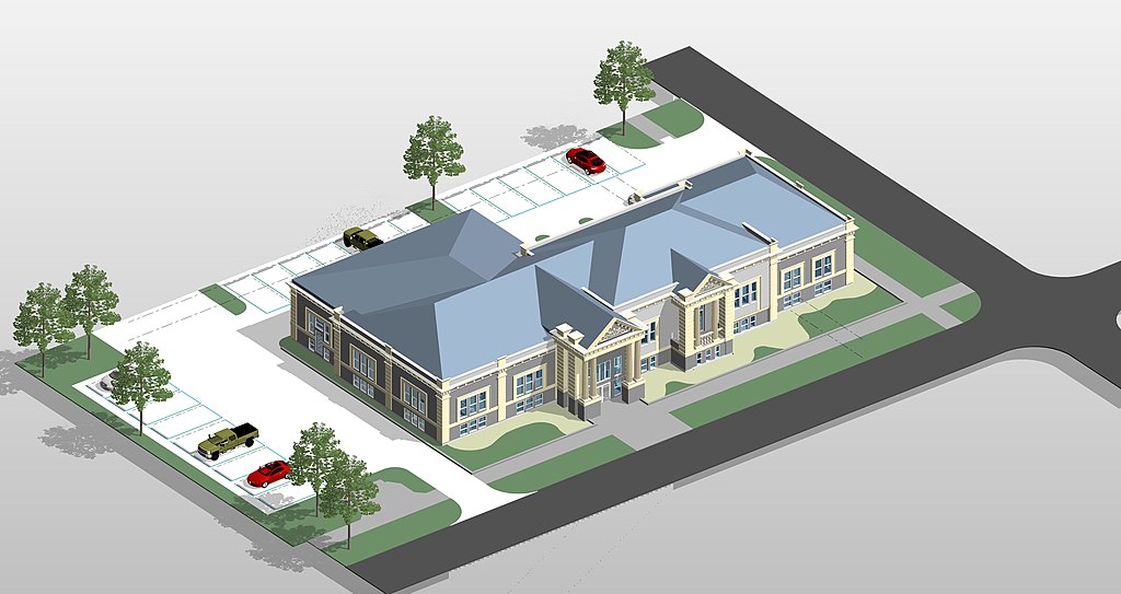
Here is an example scale model of a building. 
Example
Height of a Lighthouse
The lighthouse door is closed and the code to open it is the actual height of the lighthouse, measured in meters. For a moment, Kevin does not know what to do. He realizes that he should open the backpack his aunt gave him. Inside, he finds a scale model of the lighthouse and a tape measure.

External credits: Ekayasa.Design
Kevin figures it out and manages to measure the width of the base of the lighthouse. Also, he measures the width and height of the scale model with the tape measure.
| Scale Model | Lighthouse | |
|---|---|---|
| Width | 10 cm | 5.25 m |
| Height | 30 cm | ? |
{"type":"text","form":{"type":"math","options":{"comparison":"1","nofractofloat":false,"keypad":{"simple":true,"useShortLog":false,"variables":[],"constants":[]},"rendered":false},"text":"<span class=\"katex\"><span class=\"katex-html\" aria-hidden=\"true\"><\/span><\/span>"},"formTextBefore":"Code:","formTextAfter":null,"answer":{"text":["15.75"]}}
Hint
In a scale model, the ratio of a linear measurement on the model to the corresponding linear measurement on the actual object is always the same.
Solution
Let x be the height of the lighthouse. In a scale model, the ratio of a linear measurement on the model to the corresponding linear measurement on the actual object is always the same. This leads to writing the following equation.
The height of the lighthouse is 15.75 meters. Kevin is ready to enter the lighthouse.

actual →model →5.25 m10 cm=x30 cm← actual← model
The height of the lighthouse can be found by solving the previous equation for x.
5.2510=x30
CrossMult
Cross multiply
10x=5.25⋅30
Multiply
Multiply
10x=157.5
DivEqn
LHS/10=RHS/10
x=10157.5
CalcQuot
Calculate quotient
x=15.75
Discussion
Length Scale Factor
The length scale factor of a scale drawing or scale model is the ratio of a length on the drawing or model to the corresponding actual length where both lengths have the same units of measure.
Length scale factor=Actual lengthLength on model
Example
Finding Length Scale Factors
At the top of the lighthouse, Kevin finds a blueprint of his room and a scale model of his house shed. He understands that he must return home.
 In his room, Kevin finds a chest closed with a padlock. The pin to open it is 156 times the sum of the length scale factors of the blueprint and the scale shed.
  Kevin uses the tape measure and finds that his bed is 1.80 meters long. He then goes to the backyard and measures the width of the shed. It is 4.50 meters wide. What is the pin of the padlock?
Before finding the length scale factor, all the dimensions should be written with the same units of measure. Use the fact that 1 meter is the same as 100 centimeters to convert 1.80 meters to centimeters.

As before, write all the dimensions using the same units of measure.
The pin to open the padlock is 13.
External credits: juicy_fish
{"type":"text","form":{"type":"math","options":{"comparison":"1","nofractofloat":false,"keypad":{"simple":true,"useShortLog":false,"variables":[],"constants":[]},"rendered":false},"text":"<span class=\"katex\"><span class=\"katex-html\" aria-hidden=\"true\"><\/span><\/span>"},"formTextBefore":"Pin:","formTextAfter":null,"answer":{"text":["13"]}}
Hint
Be sure all the dimensions are written with the same units of measure before finding the length scale factor.
Solution
The length scale factor of the blueprint is the ratio of a dimension on the blueprint to the corresponding actual dimension. The dimensions of the bed on the blueprint are written on its side. Additionally, Kevin measured his actual bed length.
| Blueprint Dimensions (cm) | Actual Dimensions (m) | |
|---|---|---|
| Bed length | 9 | 1.80 |
| Bed width | 5 |
1.80 m⋅1 m100 cm=180 cm
Next, divide the bed length on the blueprint by the actual length of the bed to find the scale factor.
The length scale factor of the blueprint is 201. This means that the actual dimensions of the bed — and the entire room — were divided by 20 to make the blueprint. Similarly, the length scale factor of the scale shed can be found. The width and length of the model are known and Kevin measured the actual width of the shed.
| Scale Model Dimensions (cm) | Actual Dimensions (m) | |
|---|---|---|
| Length | 20 | |
| Width | 15 | 4.50 |
4.50 m⋅1 m100 cm=450 cm
The length scale factor is the quotient between the width of the scale shed and the actual width of the shed.
Now that both length scale factors are known, the pin of the padlock can be found. Recall, it is 156 times the sum of the length scale factors.
Pin=156(scale factor 1+scale factor 2)
SubstituteValues
Substitute values
Pin=156(201+301)
▼
Simplify
ExpandFrac
ba=b⋅30a⋅30
Pin=156(20⋅301⋅30+301)
ExpandFrac
ba=b⋅20a⋅20
Pin=156(20⋅301⋅30+30⋅201⋅20)
Multiply
Multiply
Pin=156(60030+60020)
AddFrac
Add fractions
Pin=156⋅60050
ReduceFrac
ba=b/50a/50
Pin=156⋅121
MoveLeftFacToNumOne
a⋅b1=ba
Pin=12156
CalcQuot
Calculate quotient
Pin=13
Example
Next Stop
Kevin eagerly opens the chest. He discovers a tablet! Upon powering it on, a map with a marker at his current position and another marker at his next stop appear. Kevin then presses the navigate button. Oh no! The app locks and asks him what the actual distance is between the marked places, in yards.
 According to the information given by the app, with the current zoom, the markers are 9 inches apart on the screen and the length scale factor is 0.0004. What pin unlocks the app?
External credits: Freepik
{"type":"text","form":{"type":"math","options":{"comparison":"1","nofractofloat":false,"keypad":{"simple":true,"useShortLog":false,"variables":[],"constants":[]},"rendered":false},"text":"<span class=\"katex\"><span class=\"katex-html\" aria-hidden=\"true\"><\/span><\/span>"},"formTextBefore":null,"formTextAfter":null,"answer":{"text":["625"]}}
Hint
The ratio of the distance on the tablet to the actual distance is equal to the length scale factor. Use the fact that 36 inches are the same as 1 yard.
Solution
Since a map is a scale drawing, the ratio of any length on the map to the actual length is always the same and equal to the length scale factor.
The places are 22500 inches apart. This can be converted to yards by using the fact that 36 inches are the same as 1 yard.
Corresponding actual lengthLength in map=k
This means that the ratio of the distance between the marked places on the tablet to the actual distance is equal to the length scale factor. Let x be the actual distance. According to the information given by the app, the places are 9 inches apart on the screen and the scale factor is 0.0004.
Actual lengthLength in map=k
SubstituteValues
Substitute values
x9 in=0.0004
▼
Solve for x
MultEqn
LHS⋅x=RHS⋅x
9 in=0.0004⋅x
DivEqn
LHS/0.0004=RHS/0.0004
0.00049 in=x
CalcQuot
Calculate quotient
22500 in=x
RearrangeEqn
Rearrange equation
x=22500 in
22500 in⋅36 in1 yd=625 yd
The actual distance between the marked places is 625 yards. This means that the pin that unlocks the app is 625. Enter it to see the route and follow Kevin's adventure.
Example
Length in a Scale Model
When Kevin arrived at the last destination, his father was there waiting with a huge smile and a box in his hands. Inside, there was a scale formula 1 racing car made with a length scale factor of 161!

External credits: kjpargeter
{"type":"text","form":{"type":"math","options":{"comparison":"1","nofractofloat":false,"keypad":{"simple":true,"useShortLog":false,"variables":[],"constants":[]},"rendered":false},"text":"<span class=\"katex\"><span class=\"katex-html\" aria-hidden=\"true\"><\/span><\/span>"},"formTextBefore":null,"formTextAfter":"cm","answer":{"text":["35"]}}
Solution
Let x be the length of the scale car, in centimeters. Since the length of the actual car is given in meters, convert it to centimeters first.
The length of the scale formula 1 is 35 centimeters.
5.6 m⋅1 m100 cm=560 cm
The actual formula 1 car is 560 centimeters long. The ratio of the length of the scale car to the length of the actual car is equal to the length scale factor, 161.
Length Scale factor=560x
Substitute
Length Scale factor=161
161=560x
▼
Solve for x
MultEqn
LHS⋅560=RHS⋅560
161⋅560=x
MoveRightFacToNumOne
b1⋅a=ba
16560=x
CalcQuot
Calculate quotient
35=x
RearrangeEqn
Rearrange equation
x=35
Closure
Relating the Area of a Scale Drawing to the Actual Area
The length scale factor gives the relationship between the dimensions of a scale drawing and the original drawing. Kevin wonders whether the areas are also related somehow. Use the following applet to investigate it.
 In the following table, some ratios of the area of the scale triangle to the area of the original triangle are computed.
Notice that the ratio of the scale triangle's area to the original area is equal to the square of the length scale factor. This relationship holds for any scale drawing. Finally, think about whether there is also a relationship between a scale model's volume and the actual object's volume.
| Area of Original Triangle | Length Scale Factor | Area of Scale Triangle | Ratio of Areas |
|---|---|---|---|
| 2.8 | 2 | 11.2 | 2.811.2=4=22 |
| 2.8 | 0.5=21 | 0.7 | 2.80.7=0.25=41=(21)2 |
| 2.8 | 1.5=23 | 6.3 | 2.86.3=2.25=49=(23)2 |
Loading content